Geometric Field Data Collection Mobile Application

- Published on
- Duration
- 9 Months
- Role
- Development
- Devices
- Android & IOS
- Category
- Field Geo Data Collection

+5
Andoid APP URL
Click and download your device : https://github.com/gislayer/vector-tile-server
How did the Map Publishing Software Project Begin?
Users of the GISLayer Web GIS Editor have been asking me over time about how to collect data in the field. This is because our users also want to gather data in the field. I had noticed this before, but the codes we had written were only user-friendly mobile web designs that worked on the web. Now, we have written new native code for both Android and iOS using Flutter. Some developers thought Flutter would not succeed, but applications produced by a skilled developer using Flutter are quite impressive.
This application is not only for collecting data in the field but also for visualizing your existing data in the field. In addition to this, it offers various basemaps, and you can find a destination by performing operations on a point on the field. Moreover, you can share the data you collect in the field with your friends.
Technologies Employed
Flutter and Dart were used to build the Android and iOS applications. Apart from that, all the technologies on the map are web technologies. Additionally, the part serving as an API operates through the GISLayer API. Similarly, WebSocket works in connection with GISLayer servers.
Mobile Technologies
- Flutter & Dart
- In App Server
- Webview
Back-End Technologies
- NodeJS
- Express
- Sequelize
Database Technologies
- Postgre SQL Postgis
- LocalStorage
- SQL Lite
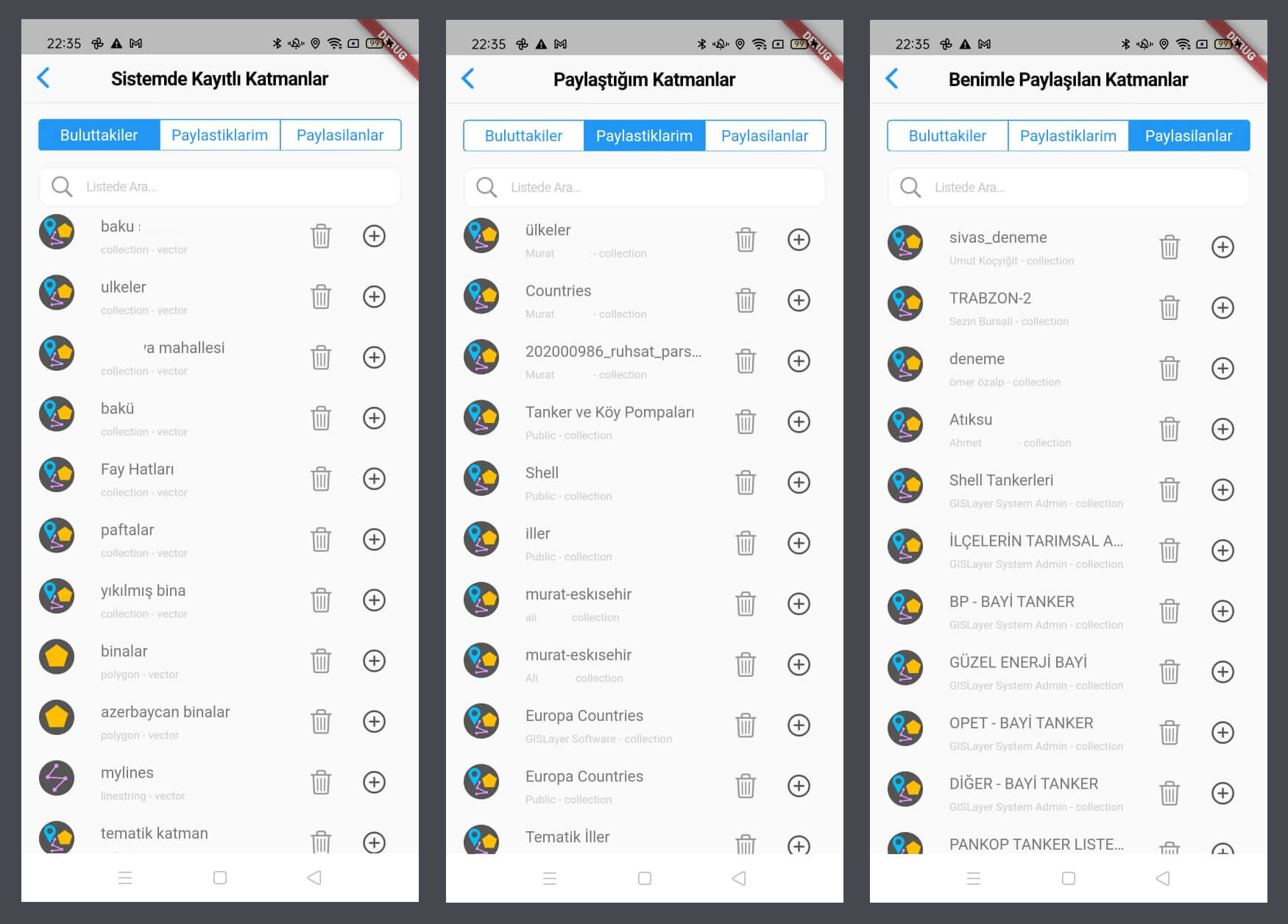
Layer Preview From Cloud Layers
Using the Web GIS Editor of GISLayer, you can upload geometric data layers from your computer to the system. You can view them on your phone using the GeoPen mobile application.

- Visualize layers uploaded to the system on the map.
- Add layers shared with you by other members to the map.
- View layers shared by you with other members on the map.
Geometric Data Visualization
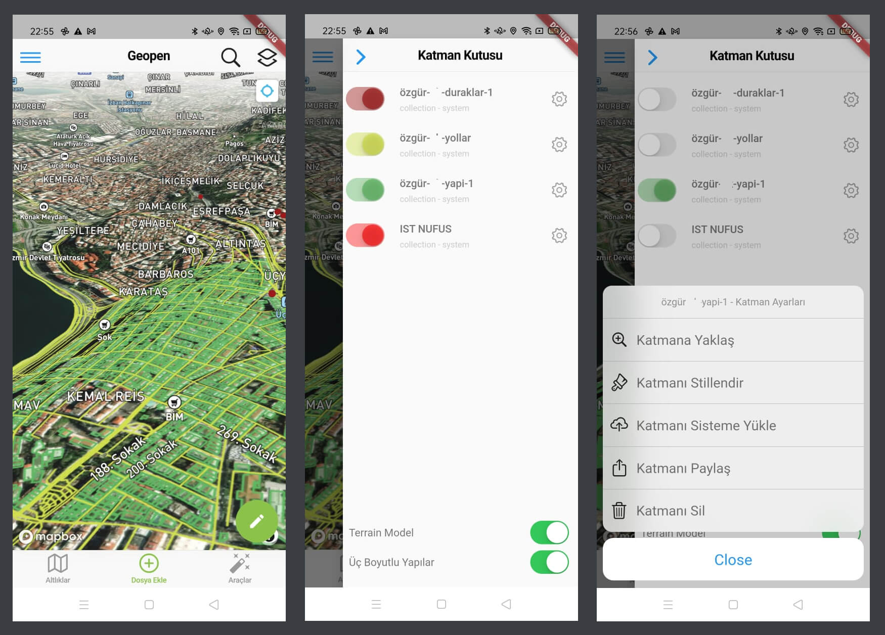
You can display and manage your geometric data on the map quickly.

- Zoom To Layer
- Changing Layer View Style
- Sending to Cloud
- Sharing to Teammates
- Layer Deleting From Map
- Hide or Show on the map
- Terrain and 3D Buildings
Basemap Types
APP have 9 different Mapbox GL JS basemaps, you can use anything for best visualization
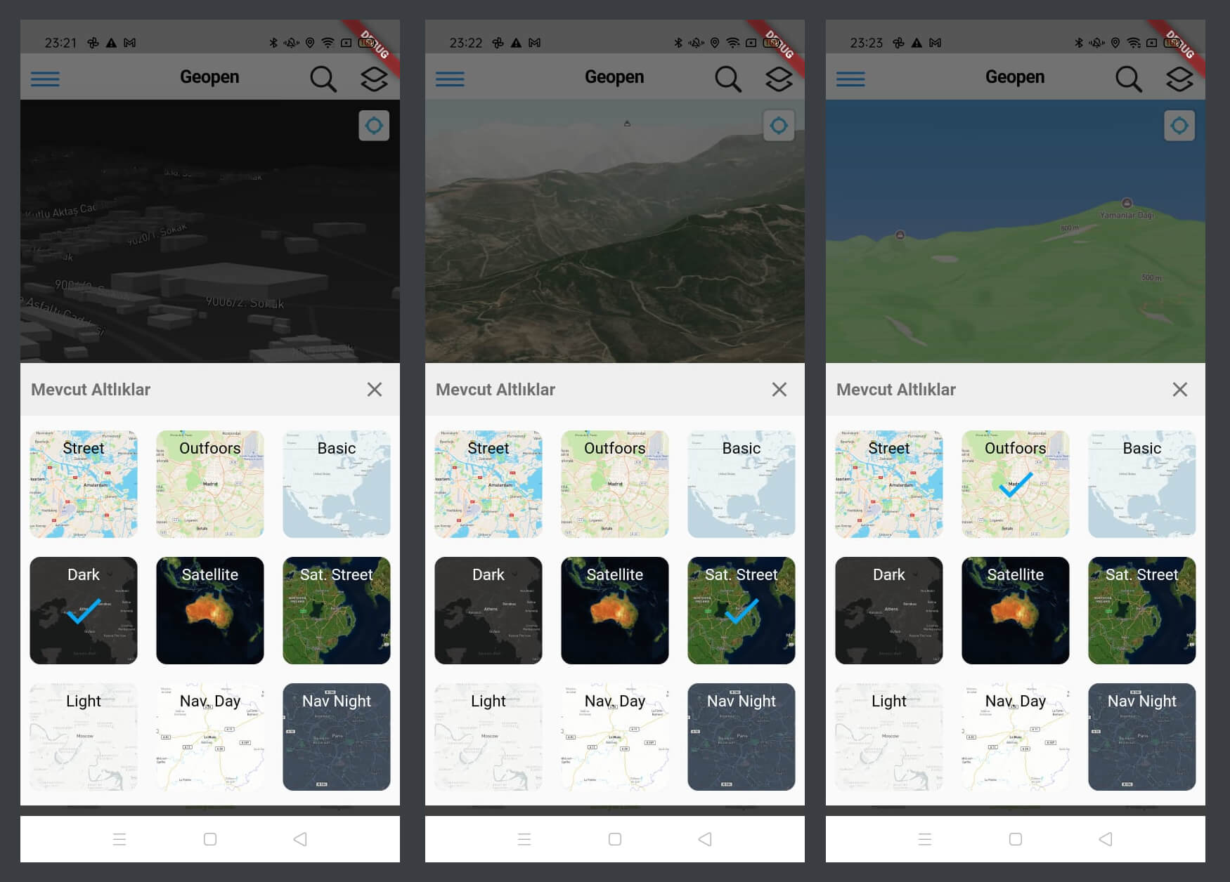
- Street Style Map
- Outdoors Style Map
- Basic Style Map
- Dark Style Map
- Satellite UnLabelled Imagery Map
- Satellite Labelled Imagery Map
- Light Style Map
- Navigation Day Style Map
- Navigation Night Style Map
Loading Local Geometric Data From Device
You can add your local geometric data to map. App supports all EPSG Code and projection systems
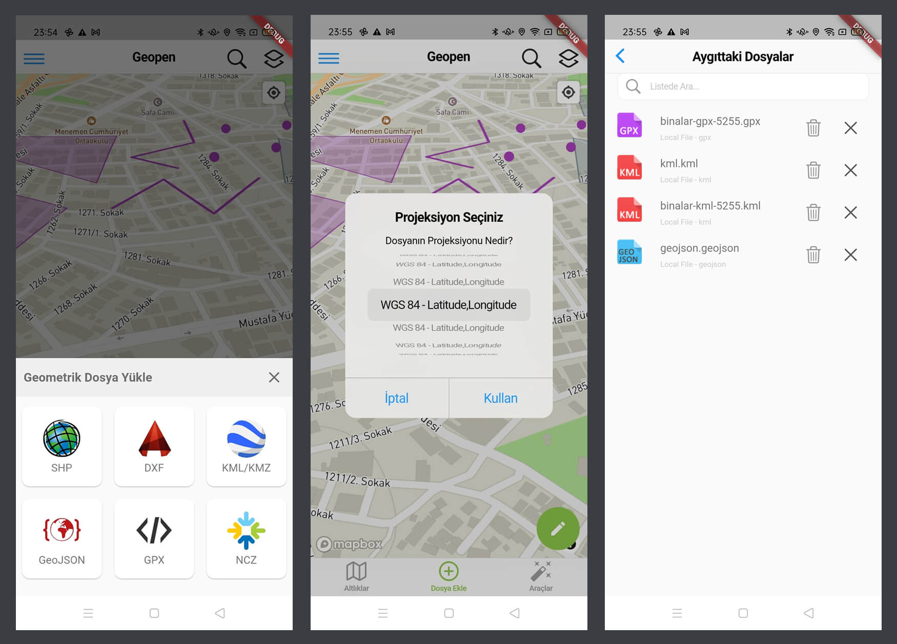
- Load Esri SHP Files
- Load AutoCad DXF Files
- Load Google Earth KML and KMZ Files
- Load GeoJSON File that OGC Support
- Load Outdoor GPX File
- Load Netcad's Special Data (For Turkey)
- Choice Data's EPSG Projection
- Delete, Share or Send to Cloud
Collecting Field Geometric Data
When field personnel collect geometric data using GPS assistance, they may want to add attribute data to these geometries. These can be easily defined, and once the drawing is complete, the information modal opens automatically.
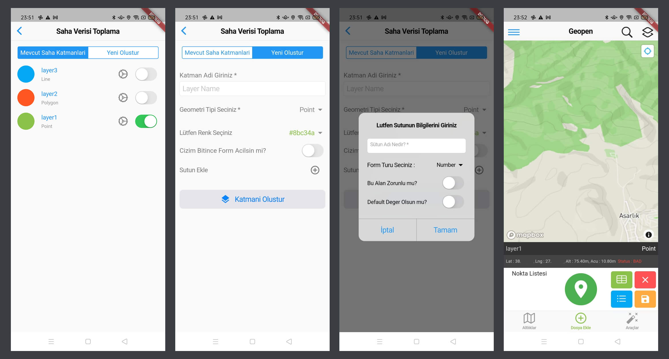
- Define Layer Name, Geometry Type, Color
- Add New Property Field for Feature Info
- Add New Property Column as Number, Text, Selection, Range or Photo
- When Collecting Geo Data open Info Modal Automaticly
Destination, GPS Tracker and Feature Info
You can establish navigation to a known coordinate or a point in the field using the destination method and navigate to the point. The system will show you the distance to the point and the angle you need to follow. Additionally, it can record your GPS track, and you can specify point collection at desired time intervals. By clicking on the geometric data you added to the map, you can obtain detailed information, bookmark it, and save it for later reference.
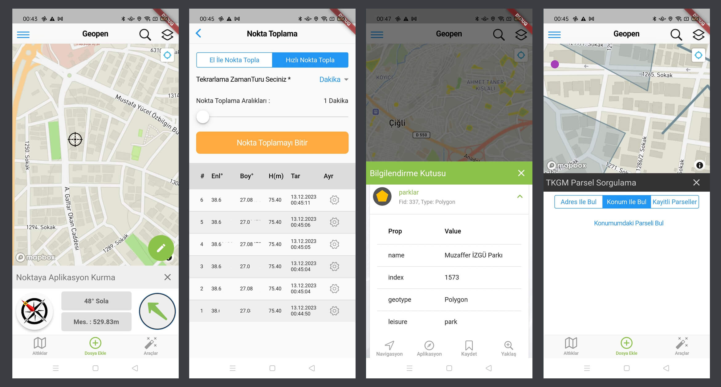
- Destination and Navigation to a Place
- GPS Tracking
- Getting Feature Info from Map
- Getting TKGM Parcels (for Turkey)
User and Team Connection Management
You can search for all GISLayer members within the system, send them follow requests to establish communication. Upon acceptance of your request, you can share your data with that person and engage in a conversation.
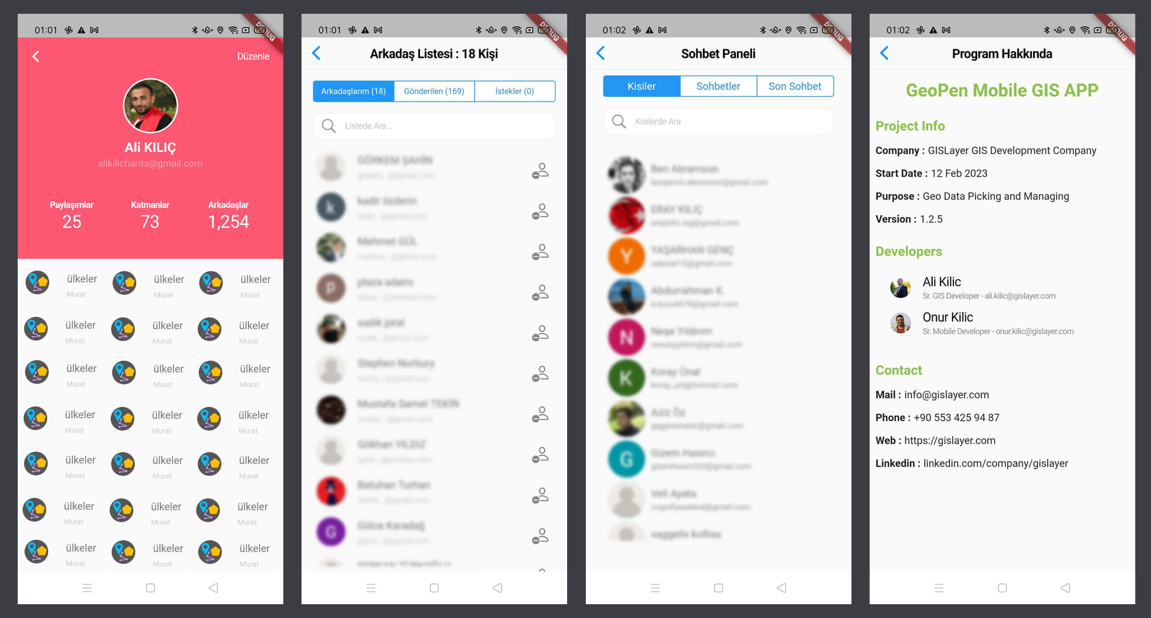
- User Search in GISLayer System
- Sending Following Request
- Sharing Data to Other Users
- Chat with Teammates or Other GISLayer Users