Categories
I write about web development and modern JavaScript frameworks.Follow My Updates
Would you like to stay informed about my new projects and blog posts?
If you'd like to stay informed about new projects and articles, please fill out and submit the form below© Copyright 2024 GISLayer
Latest Articles
A few handcrafted articles about my thoughts and experiments.
Page 1/3
network-analysiseulerian-pathhamiltonian-pathchinese-postman-problemgraph-theorySpatial Analysisshortest-path
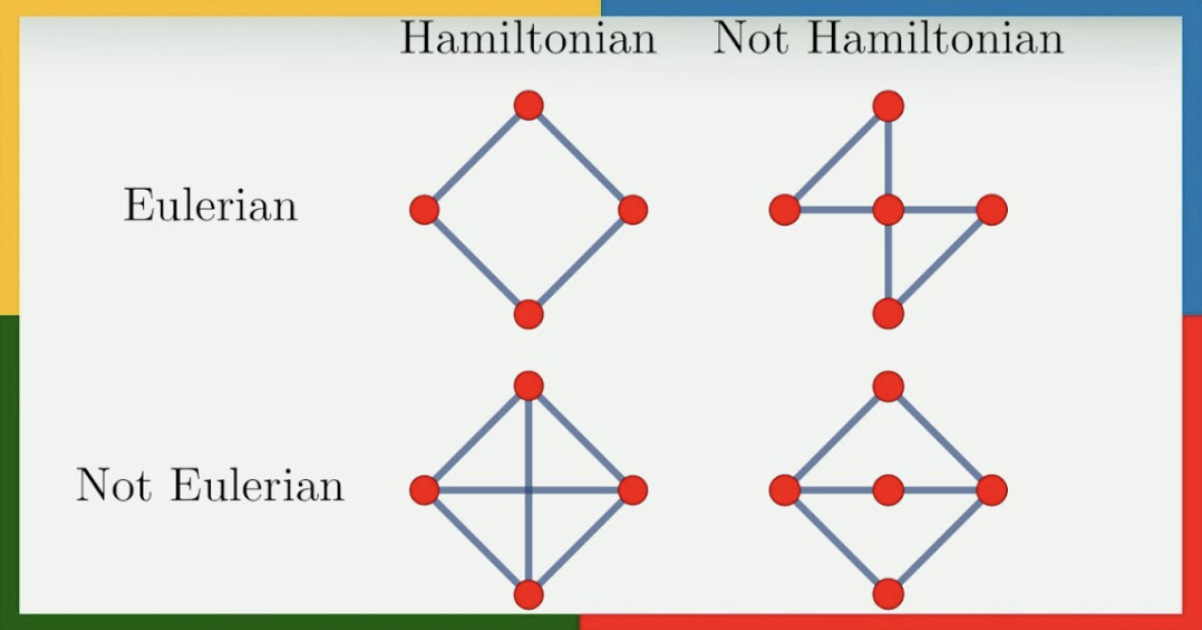
Chinese Postman Problem, Eulerian and Hamiltonian Paths, and GIS
Exploring the Chinese Postman Problem, Eulerian and Hamiltonian paths in graph theory, and their applications in GIS for optimizing route planning- Published on
network-analysiseulerian-pathhamiltonian-pathchinese-postman-problemgraph-theorySpatial Analysisshortest-path
Çinli Postacı Problemi, Eulerian ve Hamiltonian Hatlar ve CBS
Graf teorisinde Çinli Postacı Problemi, Eulerian ve Hamiltonian yolların incelenmesi ve CBS'de güzergâh planlamasını optimize etmek için kullanım alanları- Published on
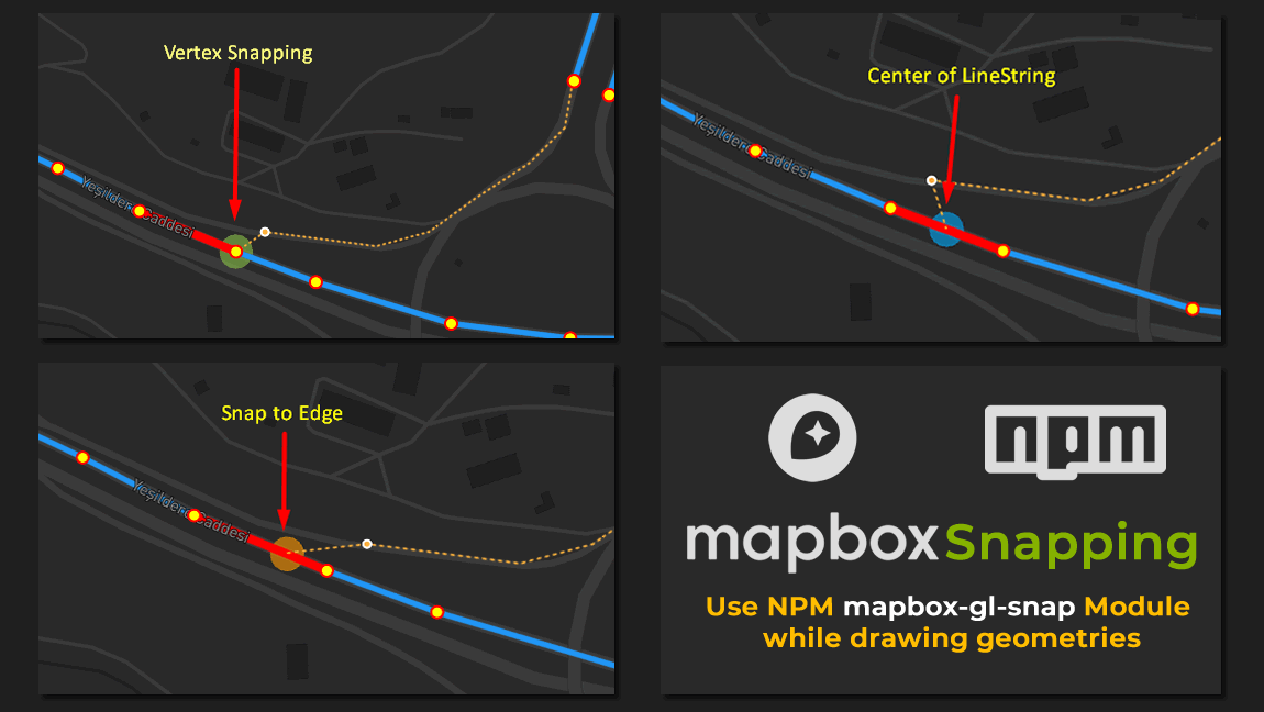
A Simplified Snapping Module for Mapbox GL JS
This blog post introduces a module that explains how to enable snapping to geometries while drawing with Mapbox GL JS- Published on
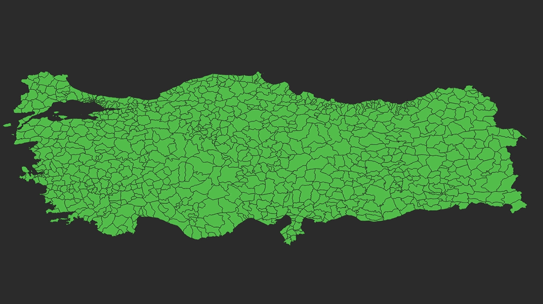
Türkiye Haritası İl İlçe Mahalle Geometrik Veri Seti
Bu blog postu Türkiye'de ki il ilçe ve mahalle verilerini geometrik olarak indirmeniz için hazırlanmıştır- Published on
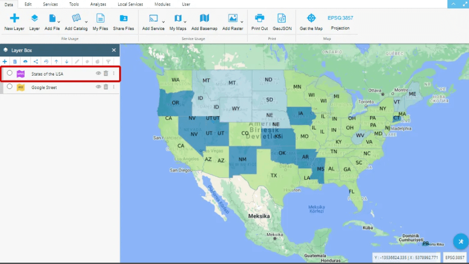
What is Web Map Service (WMS)
Easily add WMS layers to your map with GISLayer software. Watch the tutorial to learn how. View WMS sources on your map hassle-free!- Published on

Software for Controlling Network Lines and Field Task Management
With this software, you can assign real-world tasks to the geometries defined on the map as lines and monitor the traversed lines.- Published on
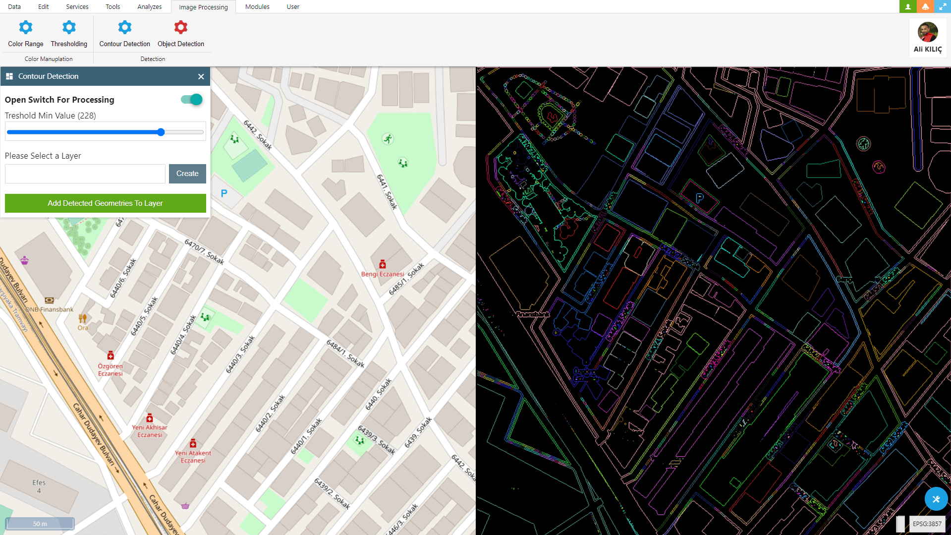
Contour Detection With OpenCV and Openlayers
Within OpenLayers, you can use OpenCV to detect and convert various geometric objects such as buildings, parcels, fields, and many more into geometries.- Published on
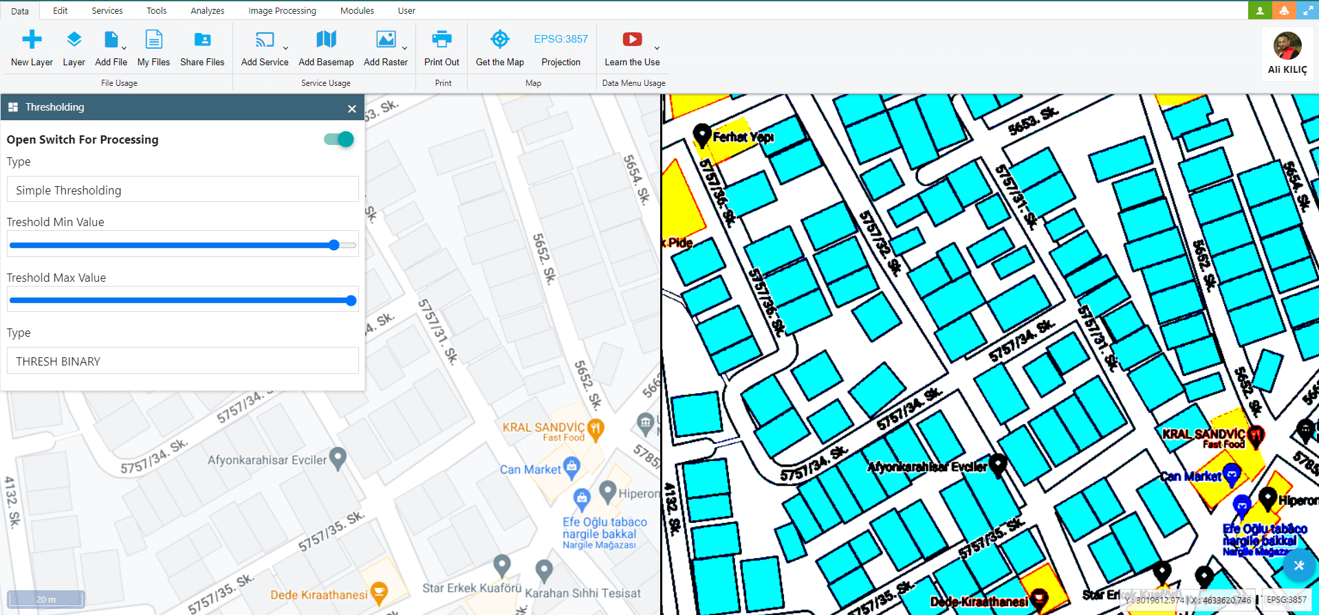
Image Thresholding With OpenCV and Openlayers
In this Blog Post, I attempted to explain how to utilize OpenCV’s Image Thresholding feature to work with GIS data on OpenLayers.- Published on
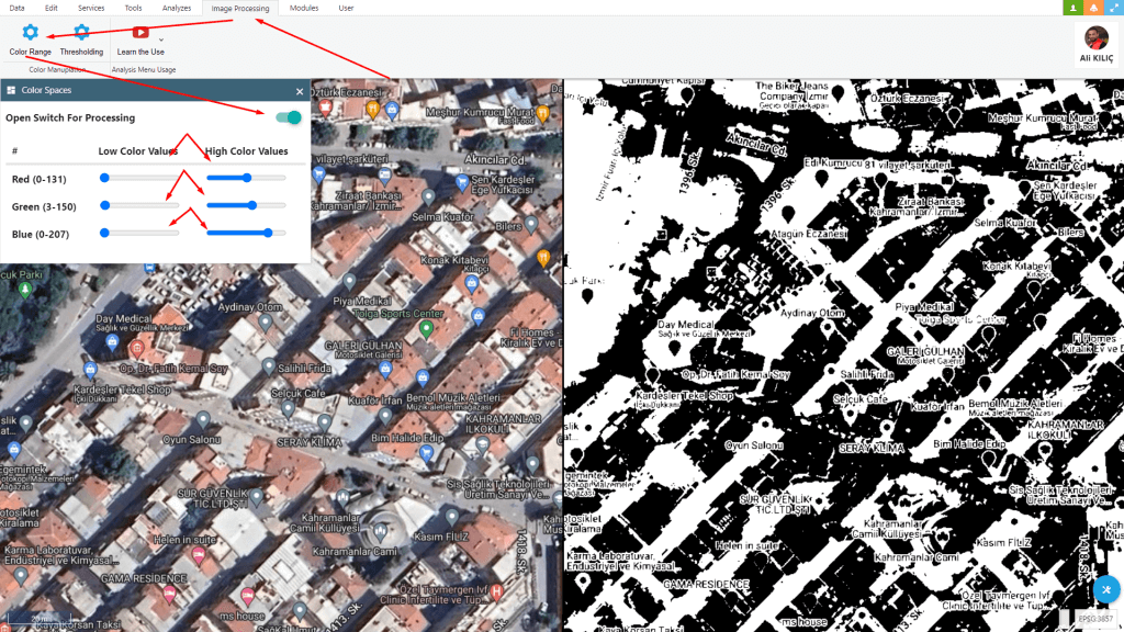
Changing Colorspaces With OpenCV and Openlayers
I tried how to perform image processing with the ‘Changing Colorspaces’ feature using OpenCV and OpenLayers.- Published on