Latest Projects
Unfortunately, I cannot share the software I have prepared for my clients here. Therefore, there are occasional products that I have developed and products related to GISLayer. I cannot provide too many details about the software I have prepared for my clients.
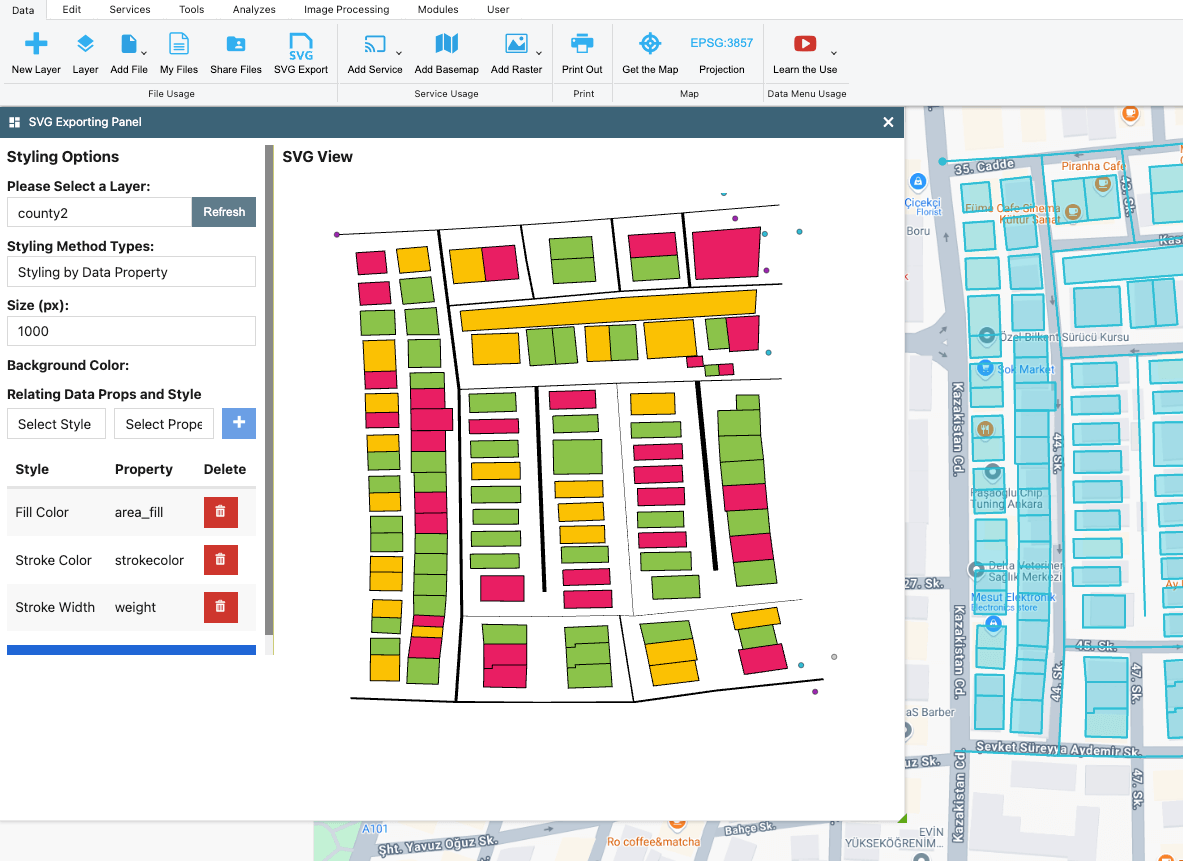
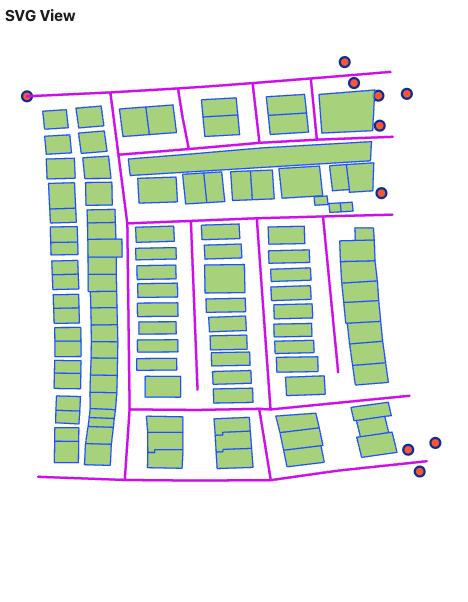
SpatialSVG – Generating Styled SVGs from GeoJSON, KML or GPX
SpatialSVG is a platform-independent TypeScript library that transforms GeoJSON data into highly customizable SVG outputs based on geometry types and styling rules.Technologies
GeoJSONSVGKMLGPXConverterSpatial SVG
- Duration
- 3 Days
- Role
- GIS Developer
- Price
- Free
- Category
- File Converter
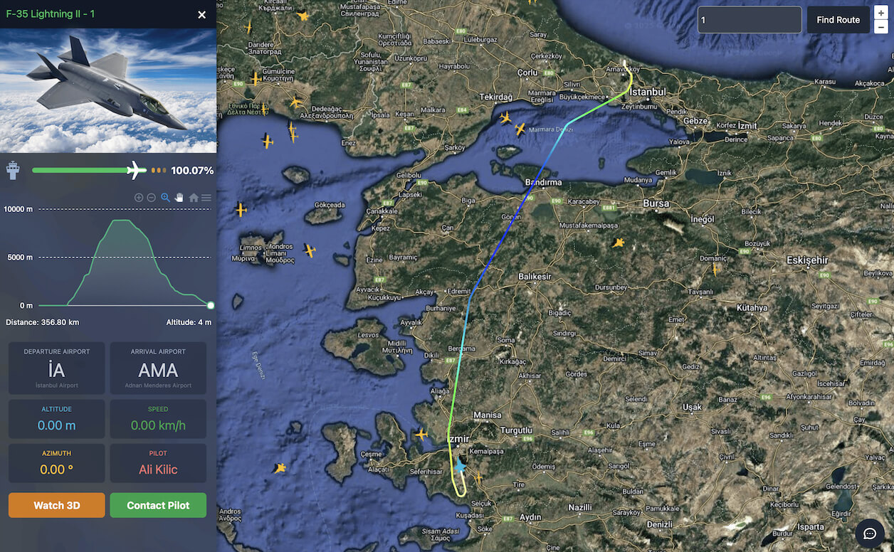
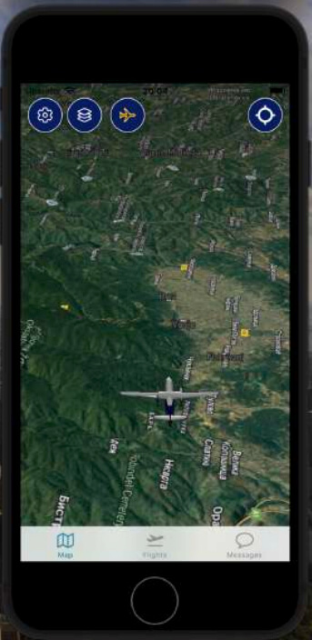
3D Flight Radar Project – Elevation Profile and Aircraft 3D Model
A real-time flight tracking system utilizing GIS and web technologies, developed with NestJS, React, and PostgreSQL with PostGIS.Technologies
Flight TrackingGISWebSocketReal-Time DataPostgreSQLNestJSReactJSOpenLayersMapbox GL JS
- Duration
- 5 Days
- Role
- Full-Stack Development
- Price
- Free
- Category
- Real-Time GIS, 3D View & Tracking
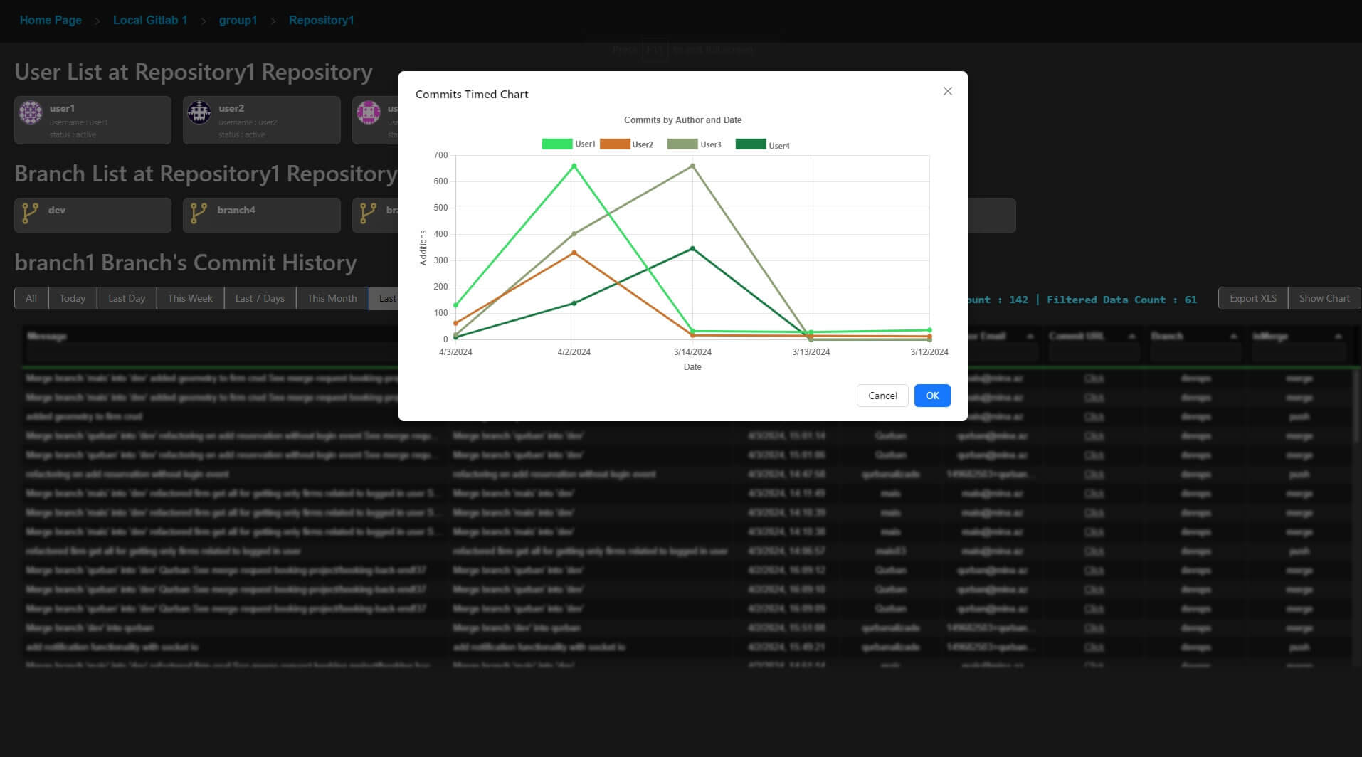
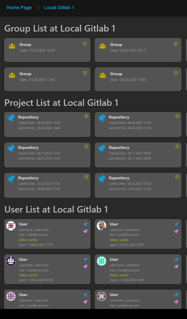
GitLab Commit Reporting Software for Admins
GitLab admins can list the groups, repositories, users, and commits they manage, and easily generate a chart for commits stats.Technologies
GitlabAdminGroupRepositoryUsersCommit AnalysisCommit ListingCommits ChartGitlab Analysis
- Duration
- 1 Week
- Role
- Management & Development
- Price
- Free
- Category
- Project Management
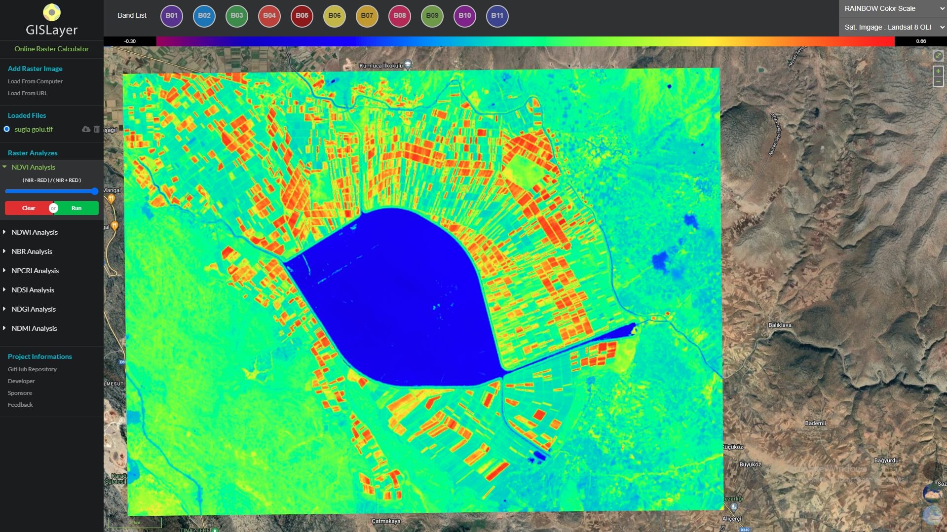
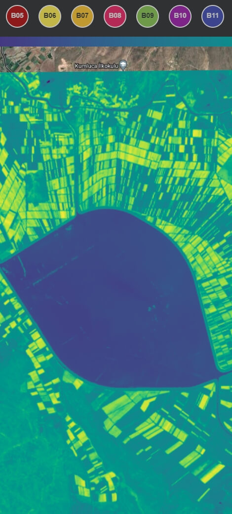
Online Remote Sensing Analysis Software
A web-based remote sensing analysis tool that help you NDVI, NDWI, NBR, NPCRI, NDSI, NDGI, NDMI AnalyzesTechnologies
Remote SensingLandsat 8 OLILandsat 5 TMSentinel 2 MSIIBGRRGBINDVINDWINBRNPCRINDSINDGINDMI
- Duration
- 2 Month
- Role
- Management & Development
- Users
- 3950
- Category
- Remote Sensing Analyzes
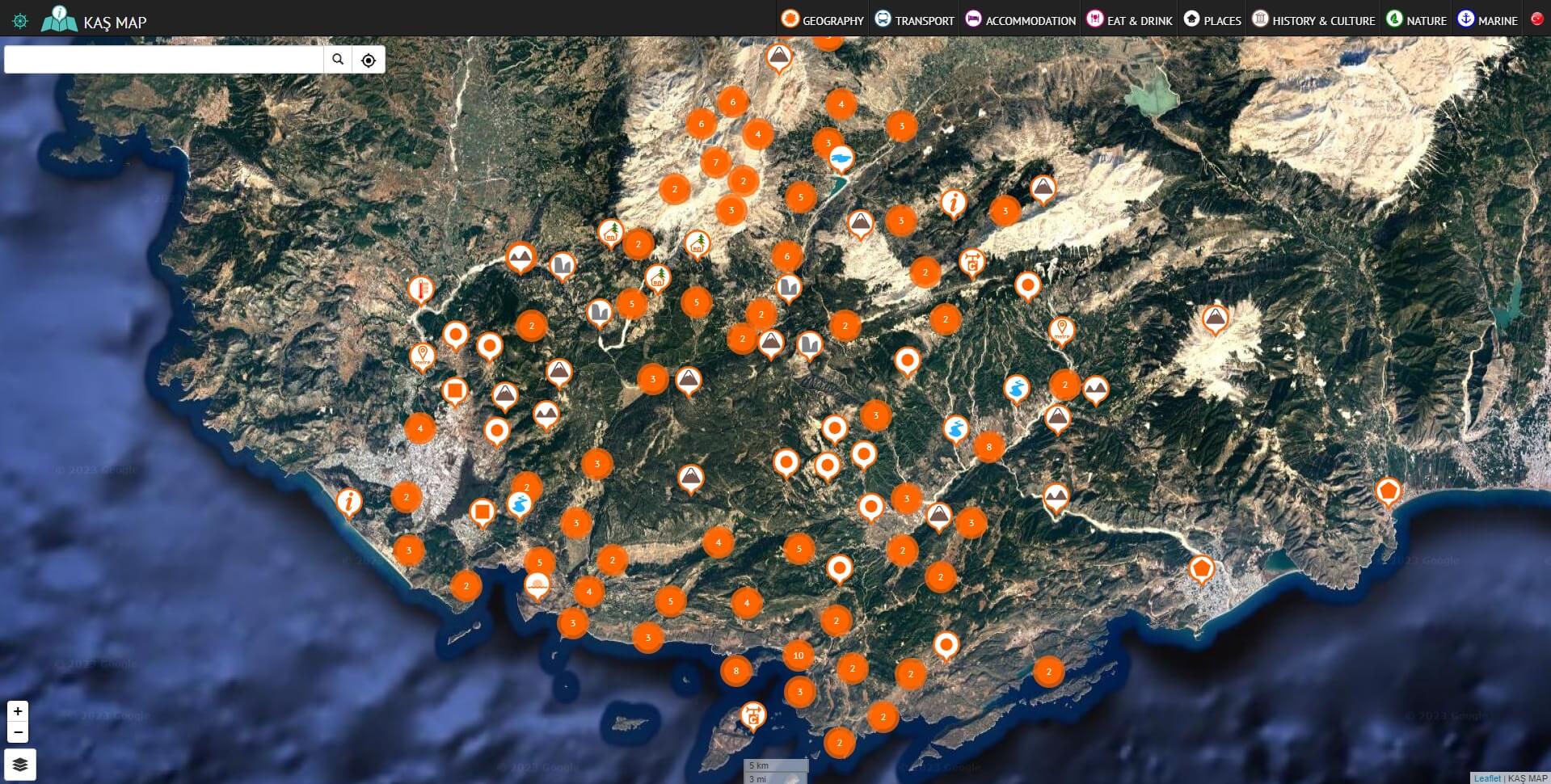
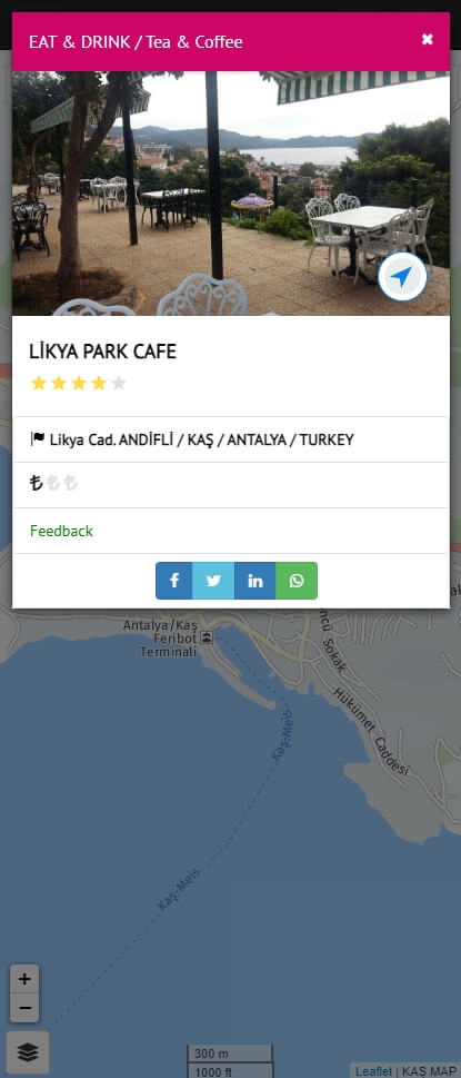
Interaktif Map Tourist Guide
This software publishes the most important Points of Interest (POI) for tourists who want to explore the city of Kas in AntalyaTechnologies
leafletphpmysqlbootstrapnavigationPOI
- Duration
- 6 Months
- Role
- Development & Management
- Owner
- Esref Mete
- Category
- POI Applications
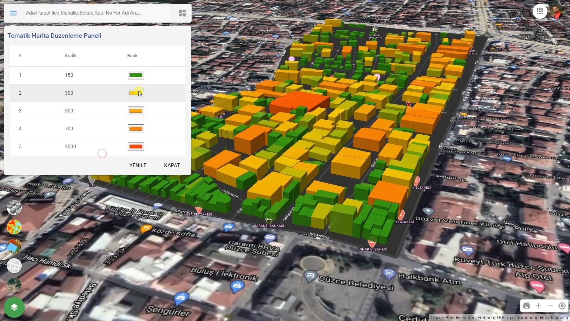
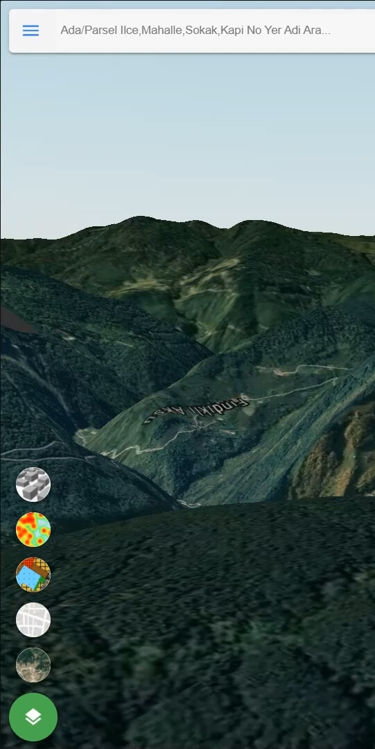
3D City Guide For Municipality
This software is used by municipalities to provide services to the local community, sharing Points of Interest (POI), title deed (Tapu), cadastre, zoning, and address information.Technologies
- Duration
- 5 Months
- Role
- Development & Management
- Owner
- Duzce Municipality
- Category
- City Guide
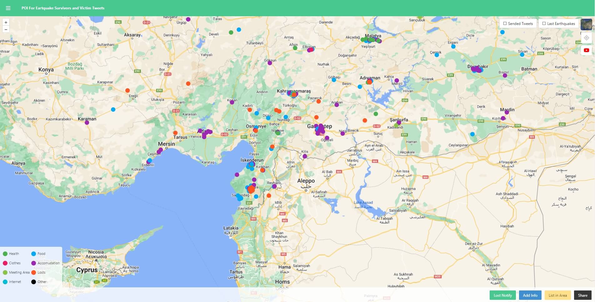
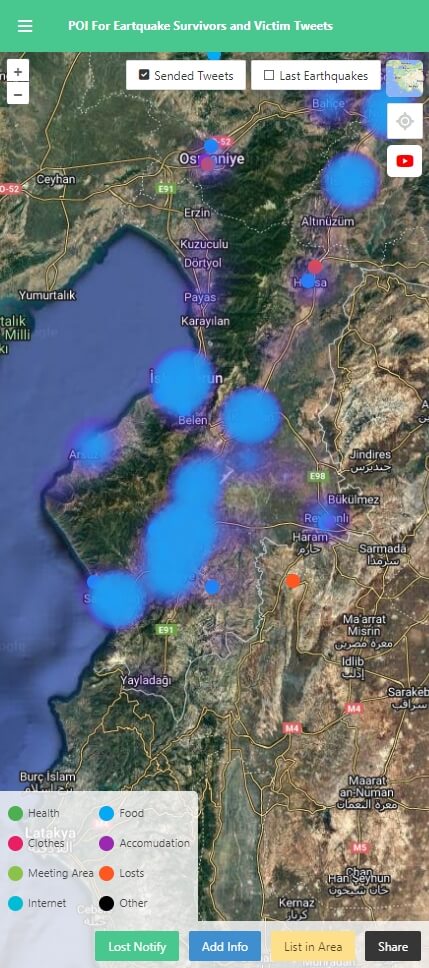
Helper POI Data For Earthquake Survivors and Tweet Locations of Victims
This software displays locations where services such as health, food, clothing, and shelter are provided for earthquake victims.Technologies
- Duration
- 3 Days
- Role
- Development
- Devices
- Web
- Category
- Aid Work
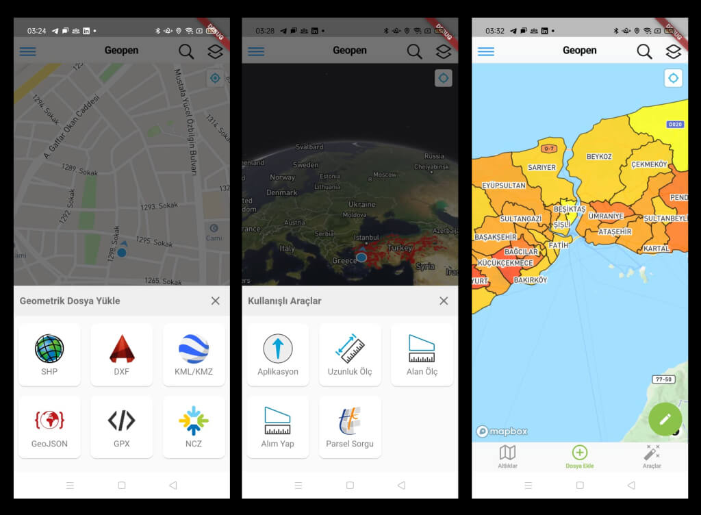
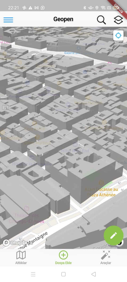
Geometric Field Data Collection Mobile Application
Geometric Data Viewing and Collection Mobile Application, where you can visualize your geometric data on a map and collect geometric data.Technologies
mapbox gl jsflutterdartdata collectornodejsturfjsshpnczdxfdestinationnavigationsqliteGeoJSONkml3d geometries
- Duration
- 9 Months
- Role
- Development
- Devices
- Android & IOS
- Category
- Field Geo Data Collection
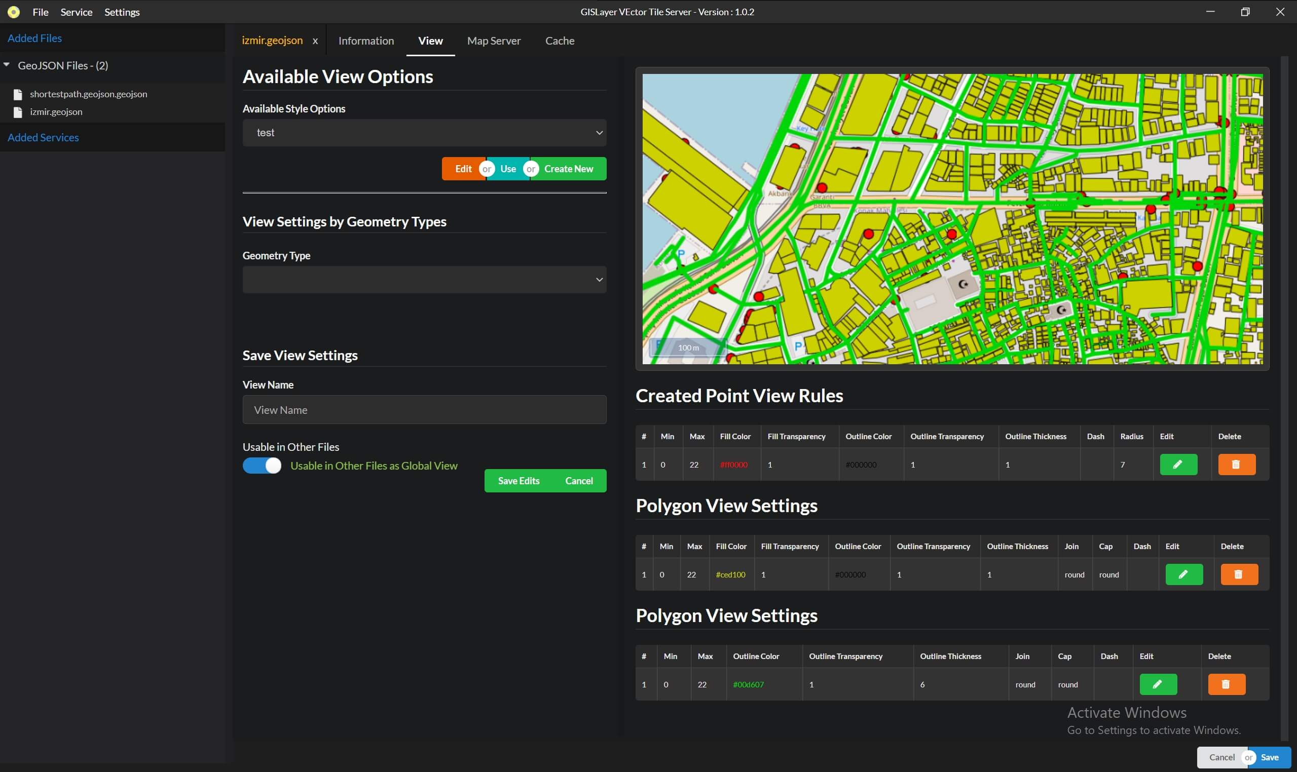
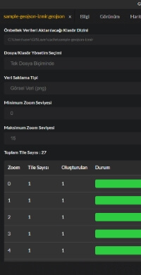
Vector & XYZ Tile Server
It is a software designed to add local or database data to the system and render it on the mapTechnologies
- Duration
- 3 Months
- Role
- Development
- Data & Tile Type
- 8 Data, 2 Tile Type
- Category
- Map Tile Publishing
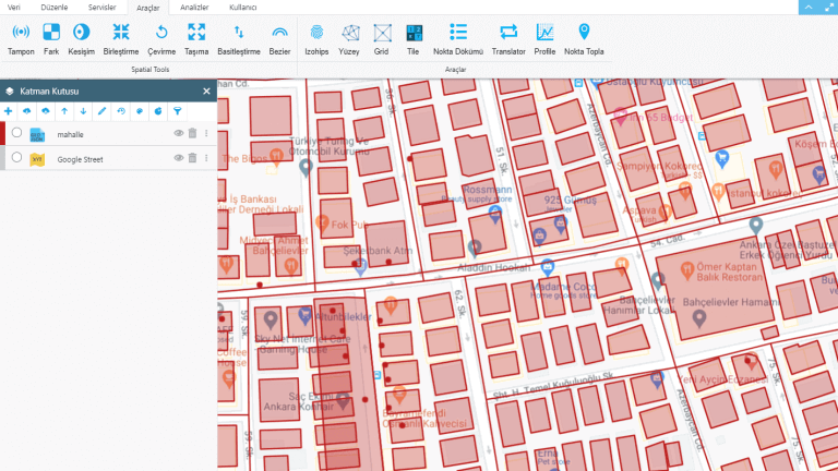
Online Web GIS Editor Tool
A web-based GIS tool that allows you to manage GIS analyses and geometric dataTechnologies
- Duration
- 2 Years
- Role
- Management & Development
- Users
- 3875
- Category
- Web & Mobile GIS
Some Open-Source Repositories
Discover my some open-source repositories on GitHub and Gitlab. A few repo imported to NPM