3D City Guide For Municipality

- Published on
- Duration
- 5 Months
- Role
- Development & Management
- Owner
- Duzce Municipality
- Category
- City Guide


+3
Demo Video
Click and Watch : 3D City Guide Video
How It Started
This project was prepared upon the request of Duzce Municipality. Unfortunately, it was not used in real life. Yes, I designed both the web and back-end aspects, but working with the government in Turkey is challenging. Therefore, I mostly collaborate with companies abroad. I was very saddened by the efforts I put into this project going to waste. I hope to extend and sell this software to different local administrations.
Technologies Employed
In this software, I made the appearance largely resemble Google Maps because there would be multiple applications, and this was just a city guide. Therefore, I decided that the CSS library should be Material Design. I prepared the components using VueJS. The professional look of Mapbox GL JS also enhances the system beautifully.
Front-End Technologies
- HTML5 + CSS + Javascript
- Material Design
- Mapbox GL JS
- VueJS
Back-End Technologies
- NodeJS
- Sequelize
- Socket.io
- GeoServer
Database Technologies
- PostgreSQL
- PostGIS
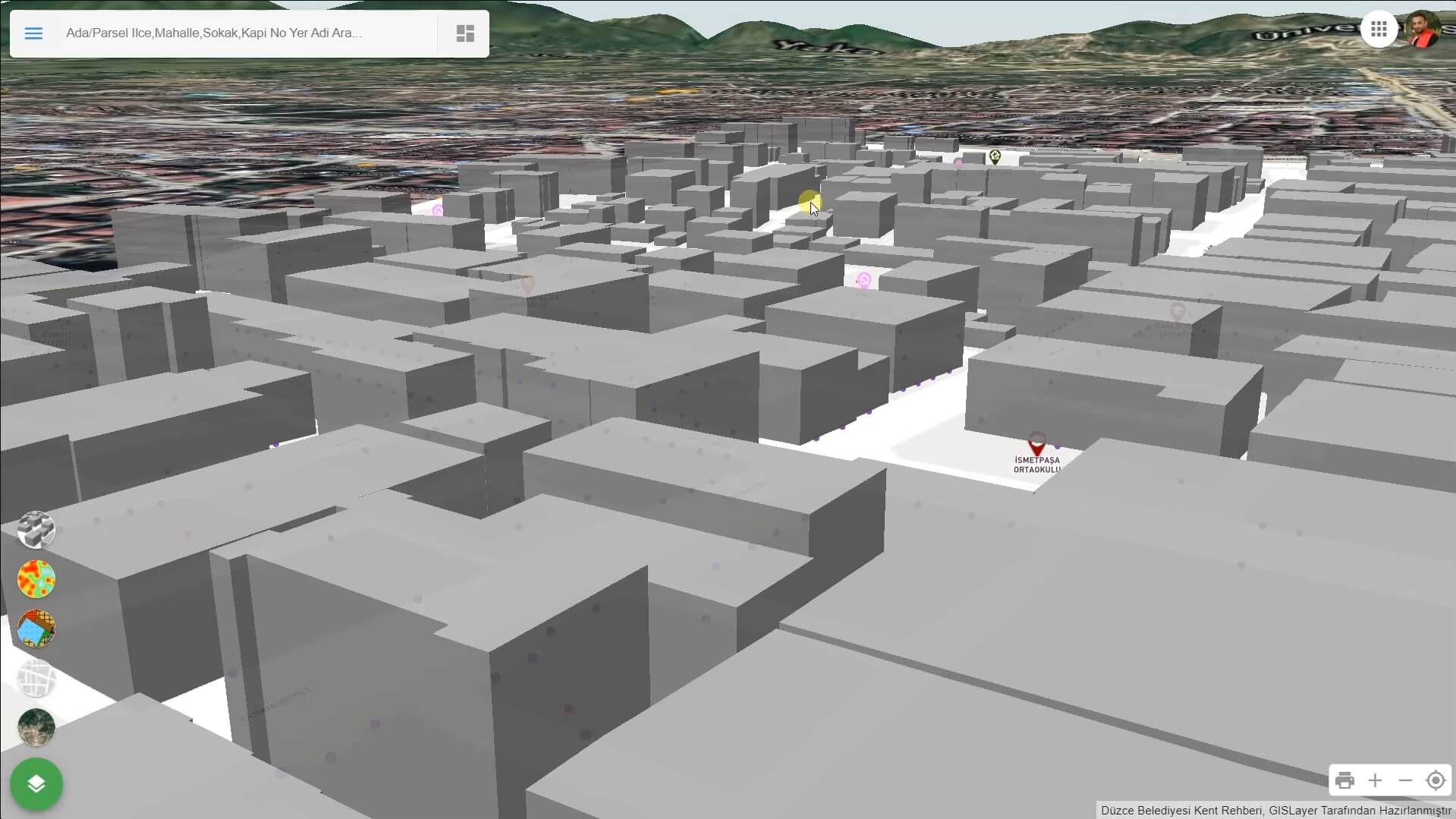
3D Buildings and Terrain Model
Even though 3D buildings are now present in many software, they had a particularly impressive appearance when I was creating this software. The beauty of mountains and peaks is a delightful feeling. Additionally, here we are not necessarily obligated to use Mapbox's data; if you have your own DEM data, it can be utilized.

- Terrain Data View with Satellite Imagery.
- Lod3 and GLTB Model Support
- Custom Terrain Data and Building Surface Pattern
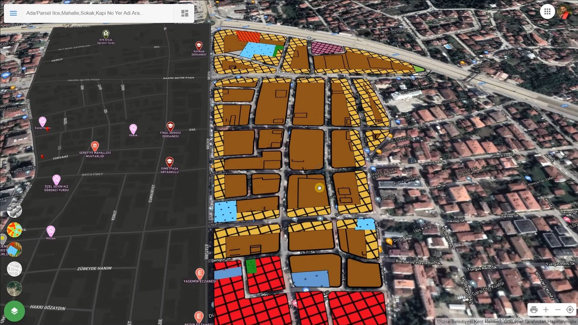
City Planing and Fill Pattern
Municipal city guides are of significant importance for showcasing zoning maps to the public and enabling the use of the address system. Many local residents use such software throughout the day.

- Fill Pattern For Plan View
- Address Searhing
- Geting News From City Guide
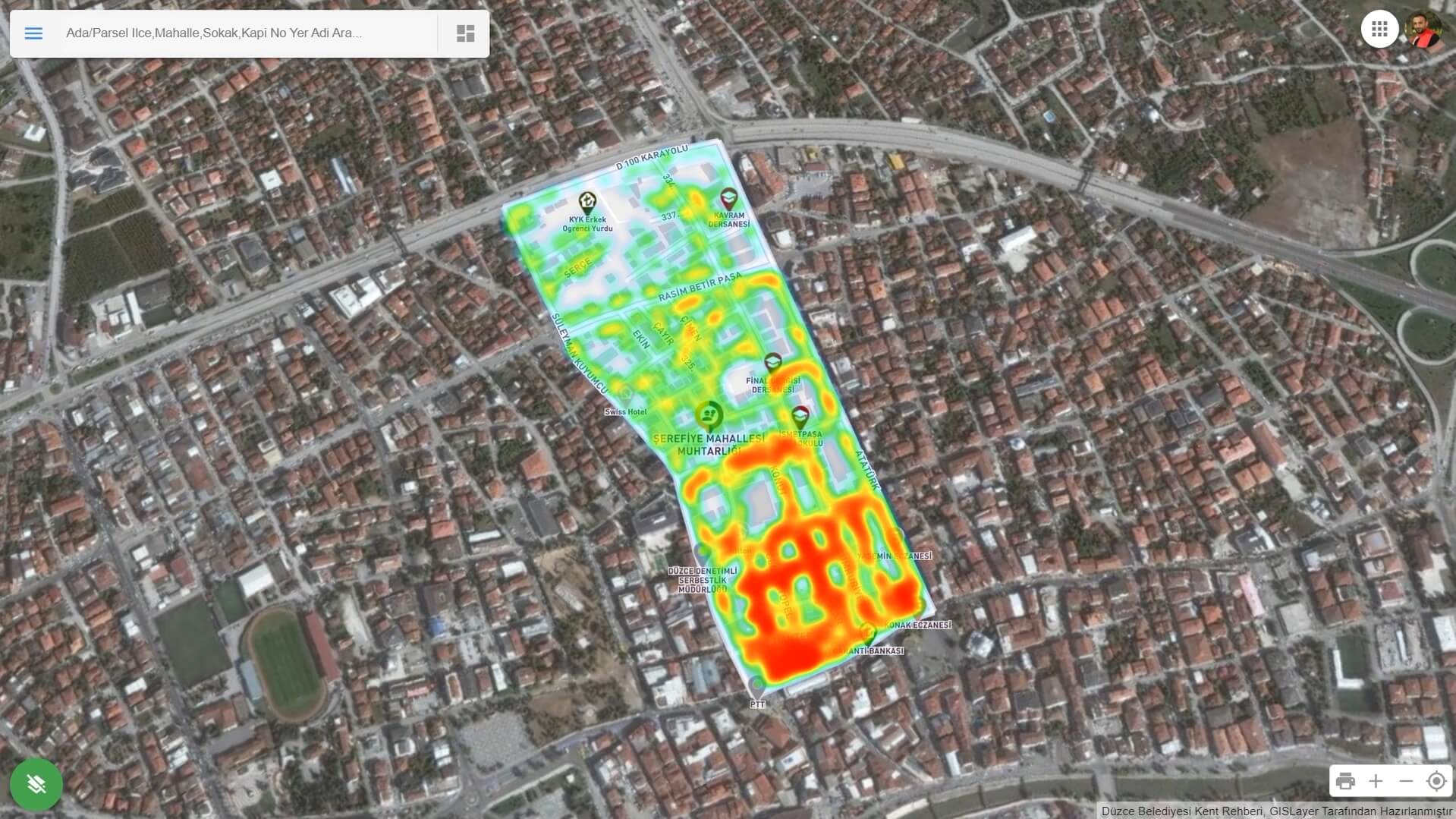
User Behaviors Heatmap Analysis
We provide various analyses by understanding which venues and locations are more popular and valuable based on users' searches and views on the system

- Popular Points of Interest
- Most Visited Places
- Most Used Public Transportation
- Regions with the Highest Traffic Accidents