Online Web GIS Editor Tool

- Published on
- Duration
- 2 Years
- Role
- Management & Development
- Users
- 3875
- Category
- Web & Mobile GIS

+5
Web Site of Tool
Click and visit here : https://editor.gislayer.com
Why important for me?
While this product may not be my magnum opus, it is a tool I introduced to my clients when founding my company, encompassing numerous features. In fact, some clients expressed a desire to innovate new products by utilizing certain features within this software. Therefore, this product is what has enabled my existence.
How did I decide to develop this software?
Before creating this tool, I was working on small tasks for my clients. Then, I thought, why aren't these features consolidated under a single platform? The answer to this question, and the realization that I needed to shoulder the responsibility of bringing these components together, led me to embark on the development journey. So, I rolled up my sleeves and took on the responsibility.
What Technologies Are Used?
When i started coding the web-based GIS software, we preferred to use current, popular, and, at the same time, future-proof technologies and elements. If we encounter a better technology in the future, i won't hesitate to adopt it.
Front-End Technologies
- HTML5 + CSS3 + Javascript
- In Component Structure with Vue Js
- Styled with Metro UI
- Openlayers 5
Back-End Technologies
- NodeJS
- Socke IO
- Sequelize
- Python
Database Technologies
- Postgre SQL Postgis
- IndexedDB & LocalStorage
- SQL Lite
Available Data and Services
Many data and services that you can add or remove to the system are listed below.

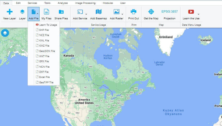
- You Can Open Esri Shape File
- You Can Open Google KML and KMZ Files
- You can Open GeoJSON, WKT, GPX File
- You can Open DXF, Excel and NCN Point File
- WFS, WMS, WFS-T, WMTS, XYZ, MVT and PPF Publications
- Google, Yandex, Bing, Esri be Here Basemaps
- Raster, GeoTIFF and Image Basemaps
Editing and Drawings
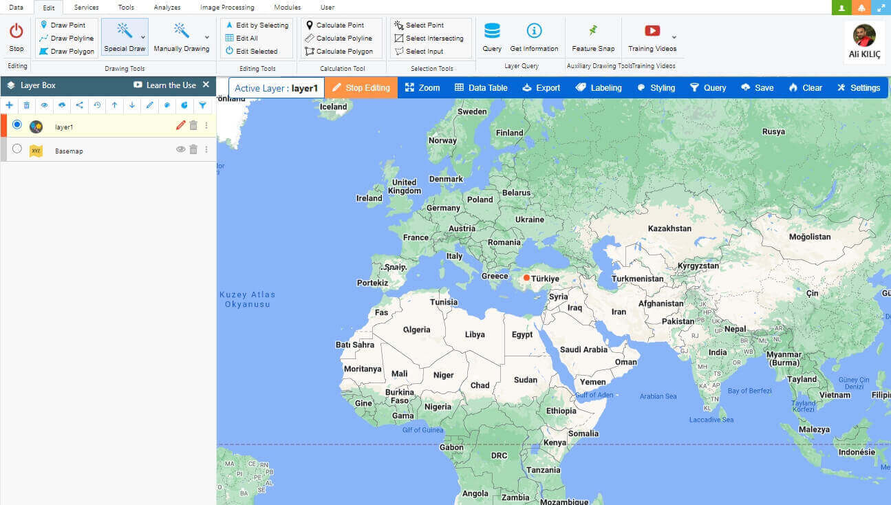
You can edit and select your vector data and make new drawings.

- Point, Line and Polygon Drawings
- Circle, Ellipse, Arc, Square, Rectangle and Special Polygon Drawings
- Special Vector Selections
- Drawing by Entering Information by Hand
- Length and Area Measurements
- Verbal and Spatial Choices
- Getting Information on the Map
Services and Data Table
You can take actions on the data table of layers with advanced features.
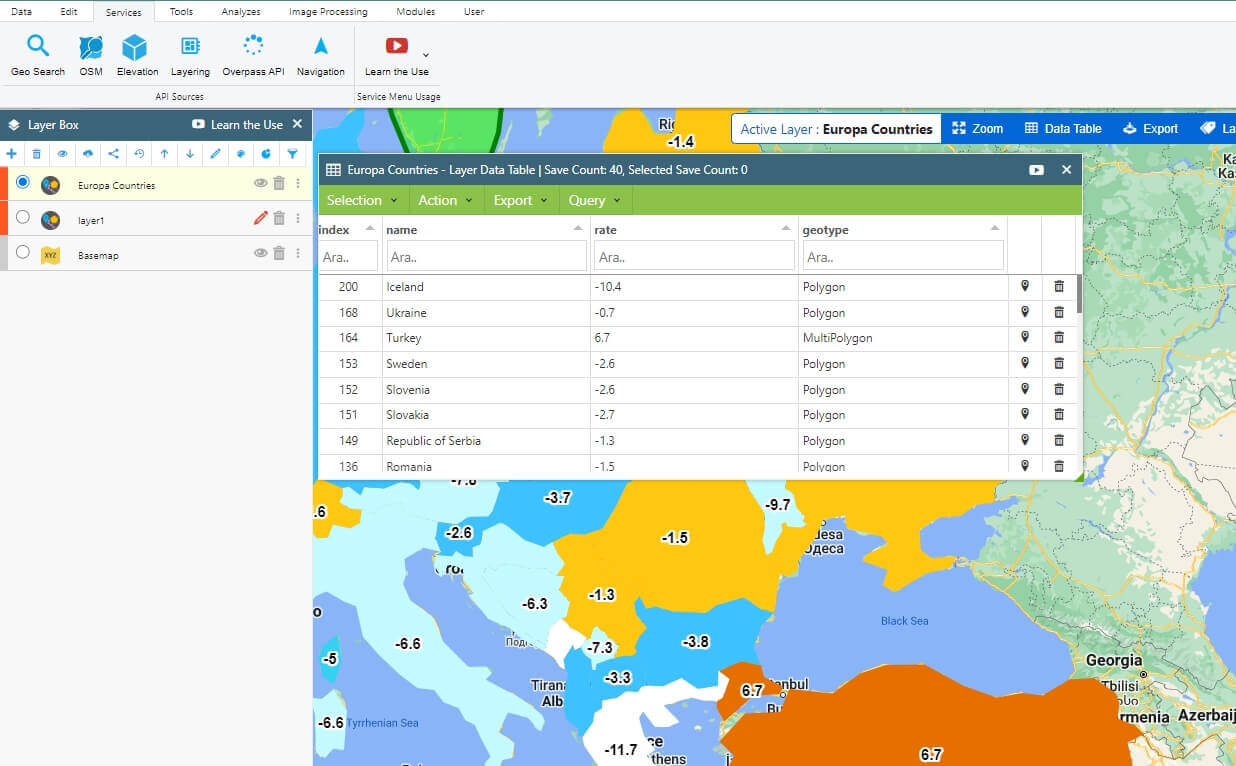
- Spatial and Verbal Inquiry and Choices
- Filtering, Color Change and Previews
- Graphics, Verbal and Spatial Exporting
- Column Editing, Making Verbal and Spatial Operations
- Layering and Searching Geometries of Special Places
- Download Elevation Data
- Getting Vectorial data by the Overpass API and OSM
Tools and Analytics
You Can Use Many Spatial Tools and Generate Analyzes. You can.
- Find differences, intersections between geometries
- Merge geometries and create a buffer zone
- Rotate on a movable axis, Geometries are simplified,
- Create Bezier, Izohips, Surface Triangulation with Geometries
- Download Raster Tile maps for offline use.
- Draw a surface profile, collect three-dimensional points
- Apply coordinate transformations to points
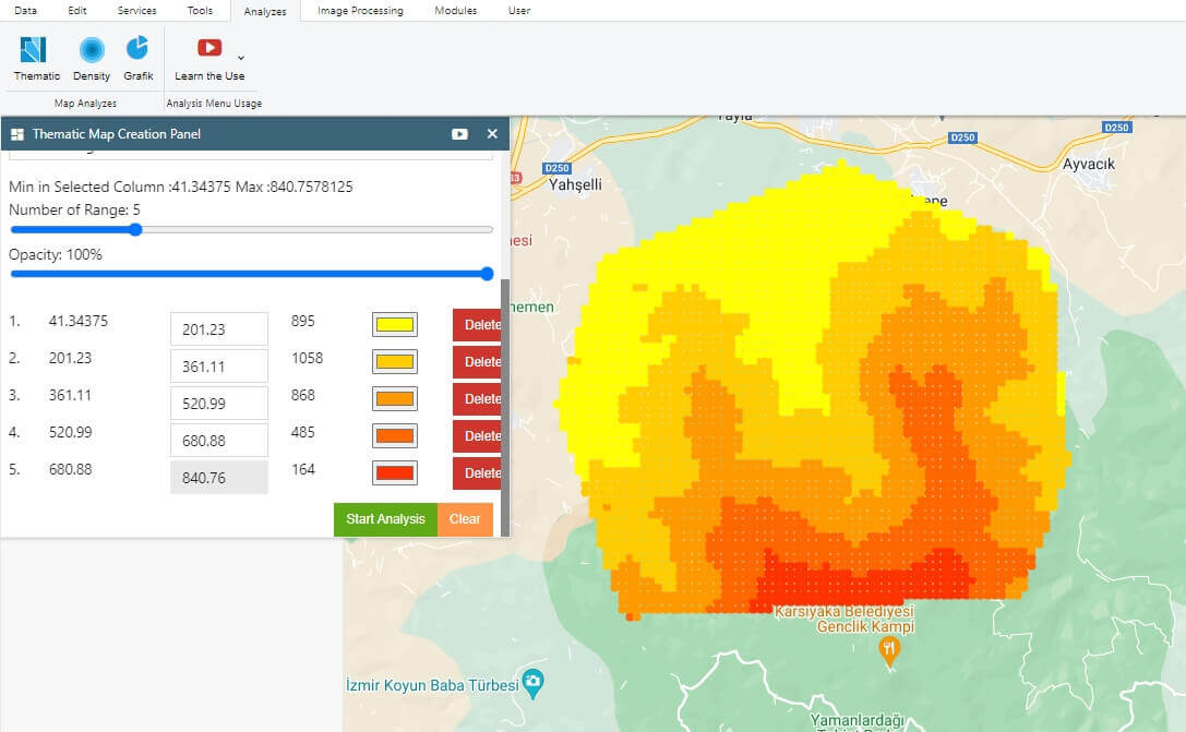
- Create thematic and heatmap density maps
- Create pie, bar, area charts with geometries
User Management
You can connect sub-users to your own management and share your data.
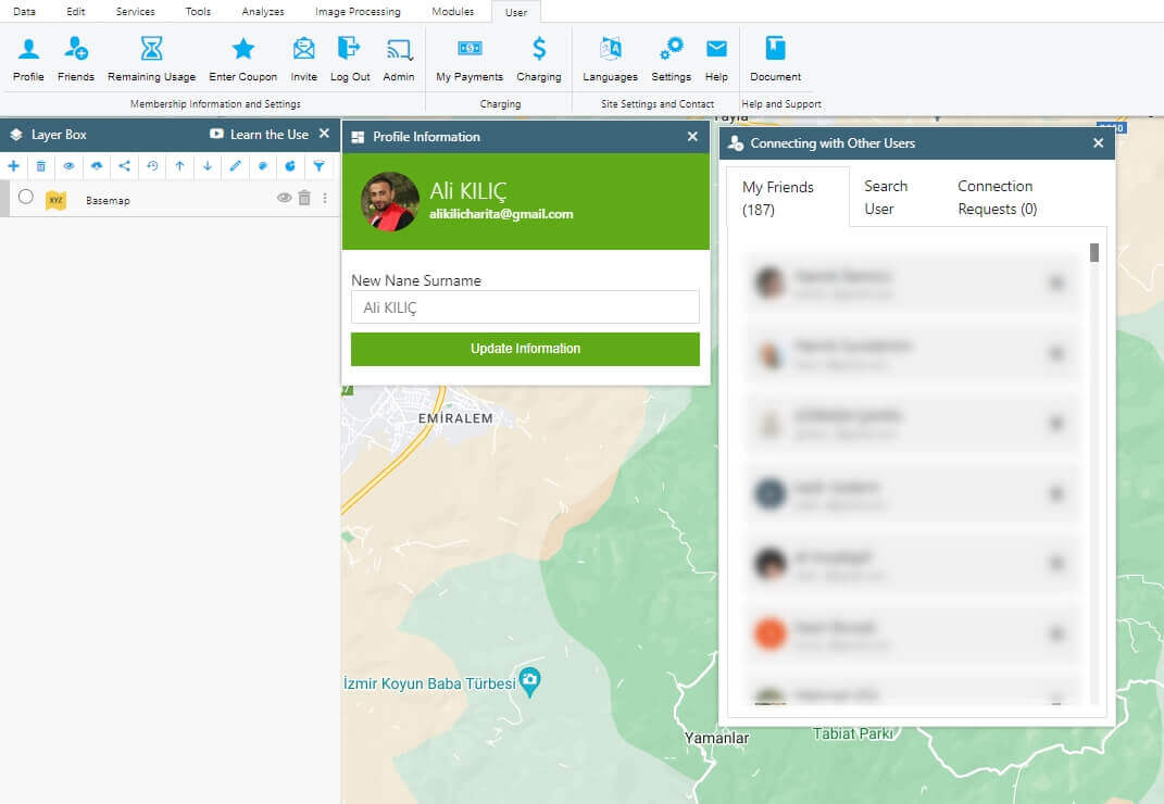
- Create your own management network by combining with users
- Share data between users according to authorization
- Share your data privately or publicly
- Buy the packages we offer you whenever you want
- Create custom packages and use only certain features
- Host your data on GISLayer servers
Image Processing
You can perform operations on basemaps or satellite images to extract thresholding and contour data. Additionally, You can convert this data into vector geometries.
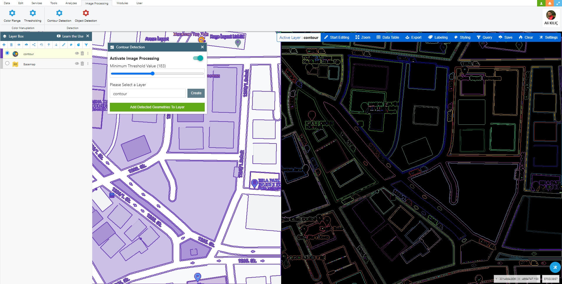
- Hiding Color Range
- Threshholding Processing
- Contour Detection
- Smilar Object Detection
Feild Data Collection
Using the application named GeoPen that I developed with Flutter, field personnel can collect geometric data based on attribute information by defining them within a single layer.
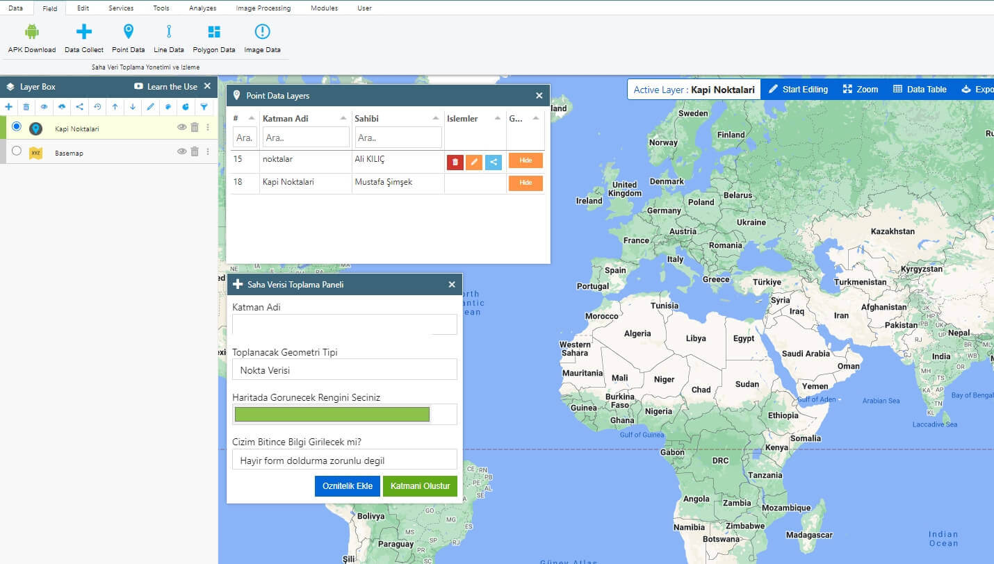
- Creating new Field Data Layer
- Collect Point Data From Field
- Collect Line Data From Field
- Collect Polyogn Data From Field
- Collect Located Image Notification From Field