Openlayers Data Articles
These blog posts has an information about Openlayers.
Page 1/1
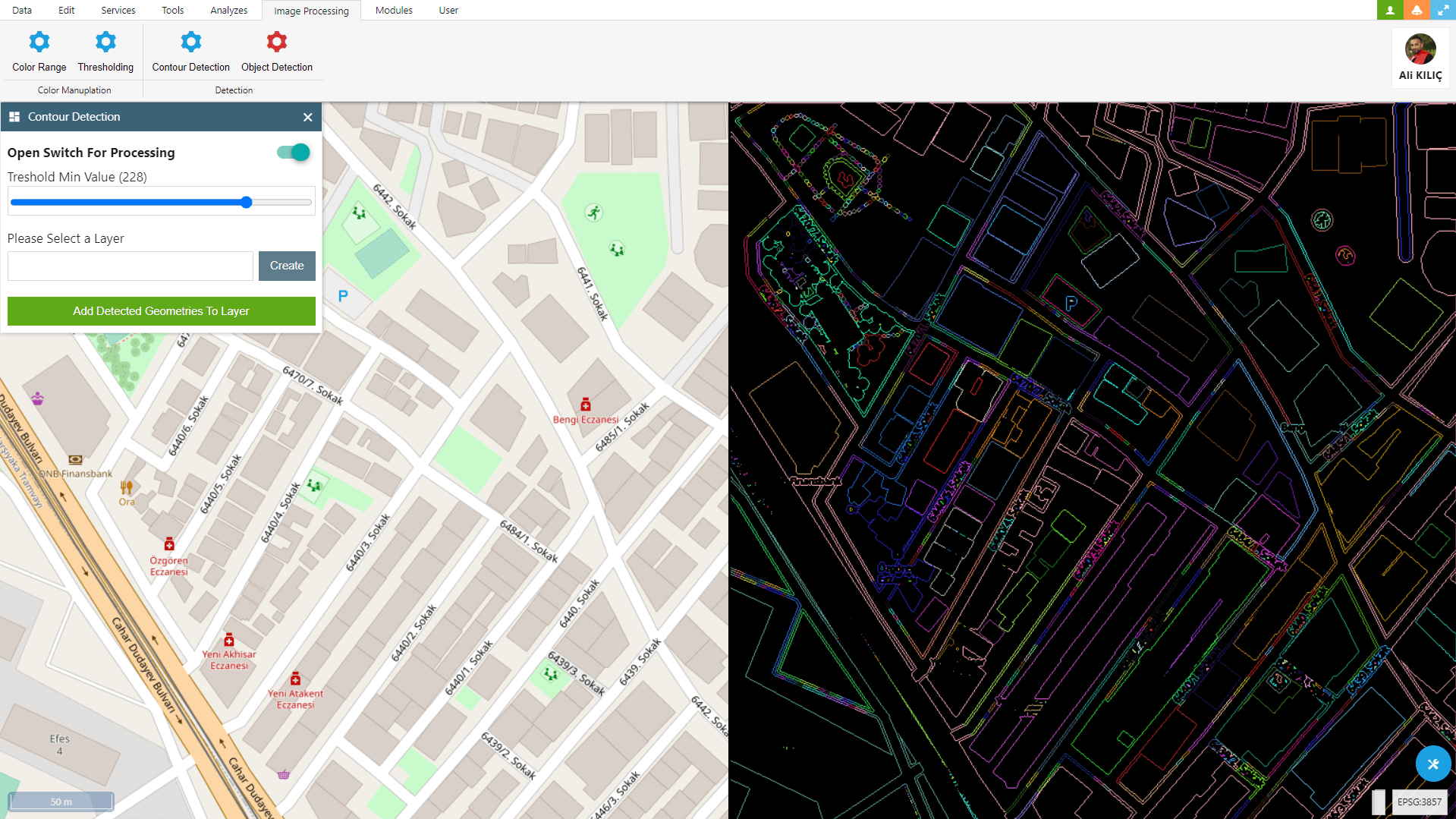
Contour Detection With OpenCV and Openlayers
Within OpenLayers, you can use OpenCV to detect and convert various geometric objects such as buildings, parcels, fields, and many more into geometries.- Published on
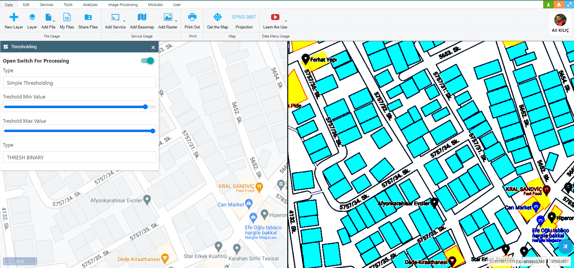
Image Thresholding With OpenCV and Openlayers
In this Blog Post, I attempted to explain how to utilize OpenCV’s Image Thresholding feature to work with GIS data on OpenLayers.- Published on
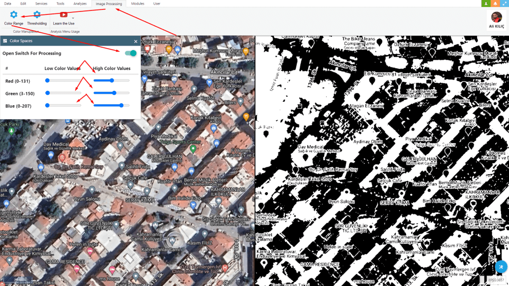
Changing Colorspaces With OpenCV and Openlayers
I tried how to perform image processing with the ‘Changing Colorspaces’ feature using OpenCV and OpenLayers.- Published on
Page 1 of 1