Categories
I write about web development and modern JavaScript frameworks.Follow My Updates
Would you like to stay informed about my new projects and blog posts?
If you'd like to stay informed about new projects and articles, please fill out and submit the form below© Copyright 2024 GISLayer
Latest Articles
A few handcrafted articles about my thoughts and experiments.
Page 2/3
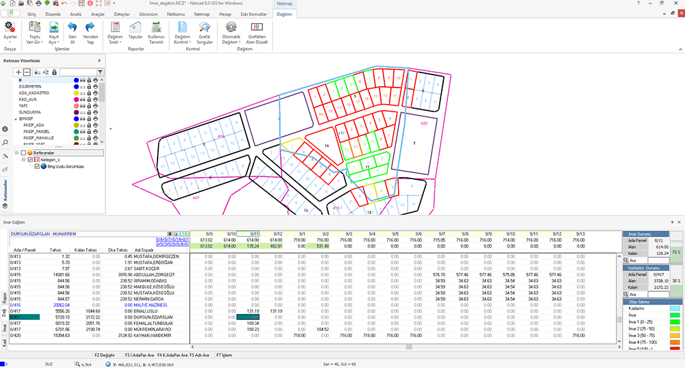
Netcad NCZ Dosyalarını Web’te Açma
Netcad NCZ dosyasını web’te nasıl açıp harita üzerinde görüntüleyeceğinizi anlattım. NCZ dosyalarınızı online bir şekilde kontrol edin.- Published on
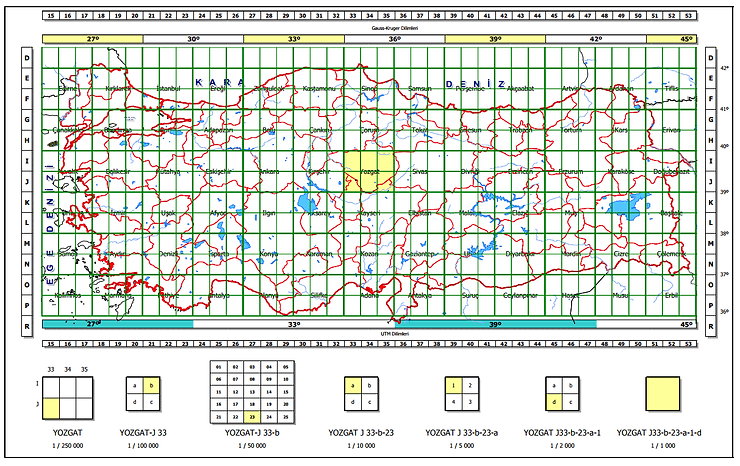
Map Layout Grid System
I have developed a map indexing system. We are using this section layout algorithm in the Turkey. Also i have developed a algorith for GARS- Published on
Spatial Queries and Functions – PostGIS Vol.1
You’ll learn; Creating a Spatial Table, AddGeometryColumn, DropGeometryColumn, ST_GeomFromText and other spatial queries- Published on
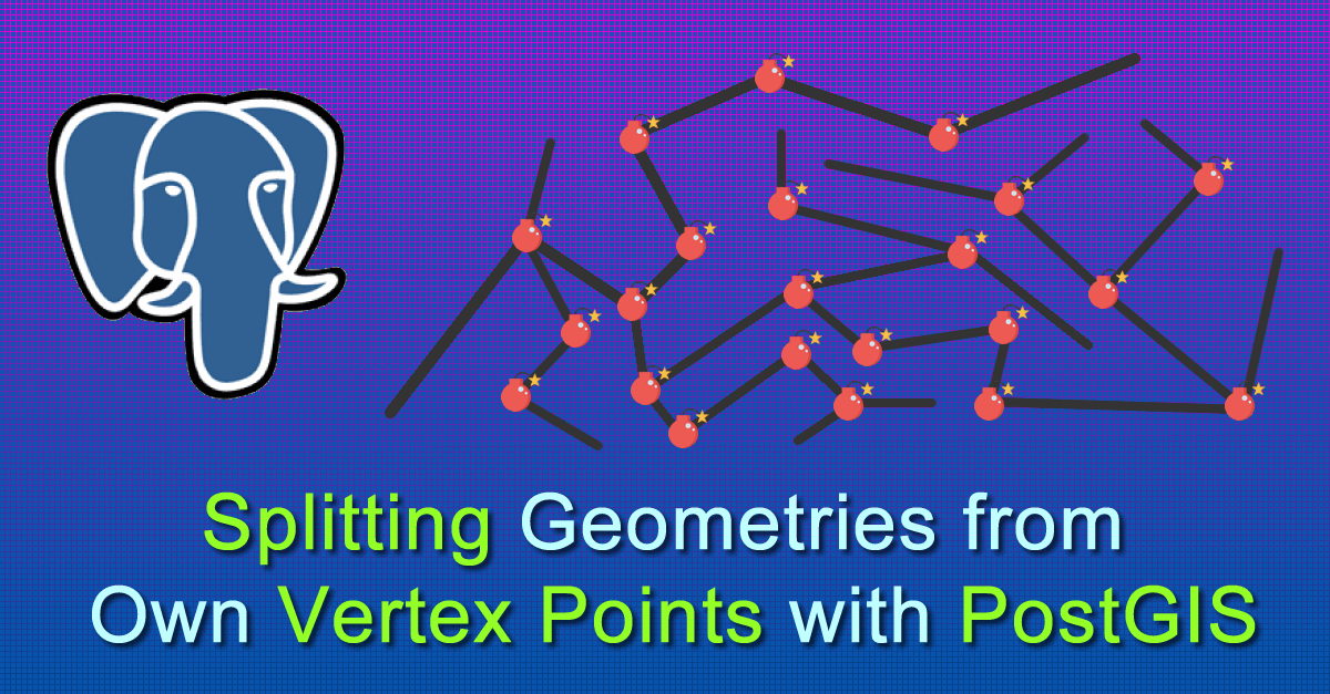
Splitting Geometries from Vertex Points with PostGIS
You can get segments of Lines – LineString with PostgreSQL PostGIS. How to do split Lines on own vertex point with SQL. Finding Segments- Published on
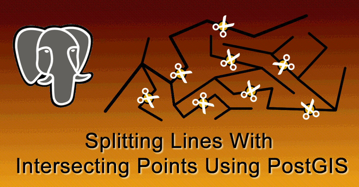
Splitting Lines With Intersecting Points Using PostGIS
You’ll learn how you can split your linestring spatial table with point spatial table. 2 DB table and split all lines with intersect points- Published on
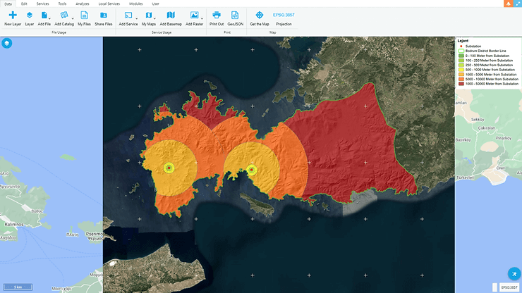
Wind Power Plants and GIS
Using environmental information to determine the most accurate location for the wind power plants, solutions can be produced with GIS analys- Published on
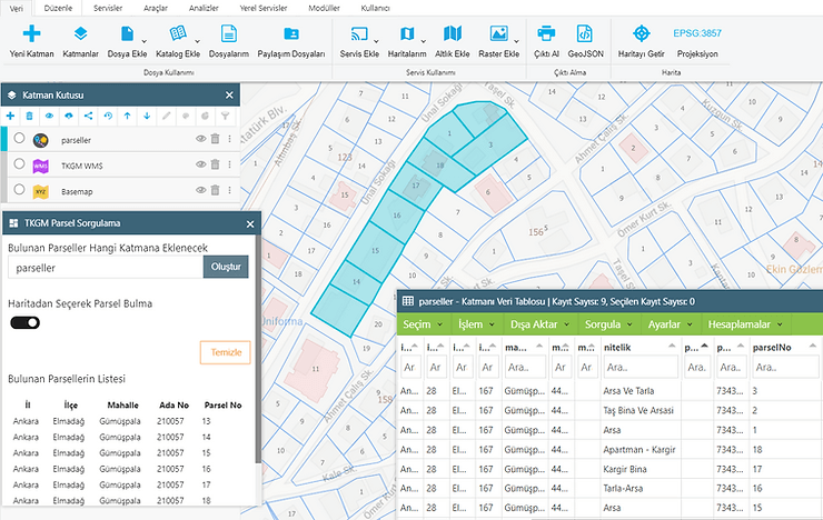
Toplu TKGM Parseli İndirme
GISLayer Web Editorunu kullanarak adrese gore veya konuma gore parsel geometrilerini toplu halde indirebileceginiz yazilim tanitilmaktadir- Published on
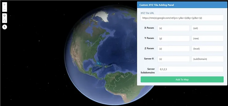
Adding Custom XYZ Tile – ArcGIS JS API
Adding XYZ raster Tile with ArcGIS for javascript API. Using WebTileLayer with ArcGIS Javascript API. How to use ArcGIS WebTiledLayer?- Published on
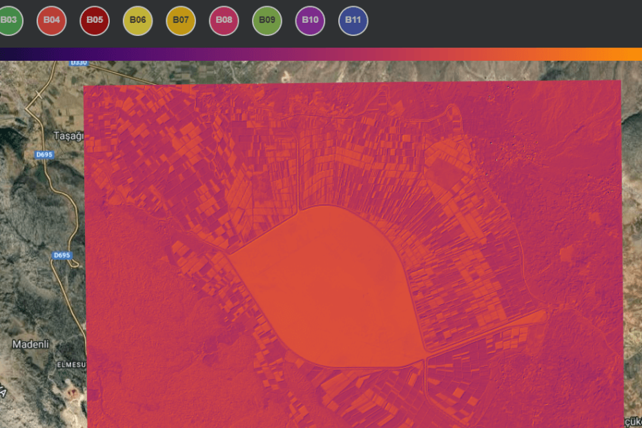
Online Remote Sensing Data Analysis & Mapping Services
It’s Open-source Web Based a Remote Sensing Anaylsis Tool Analys to Landsat 5 & 8 Sentinel 2 Multispectral Bands and calculate raster data- Published on